Research
My research focuses on using signals from global navigation satellite systems (GNSS) for other purposes than positioning.
GNSS-Reflectometry
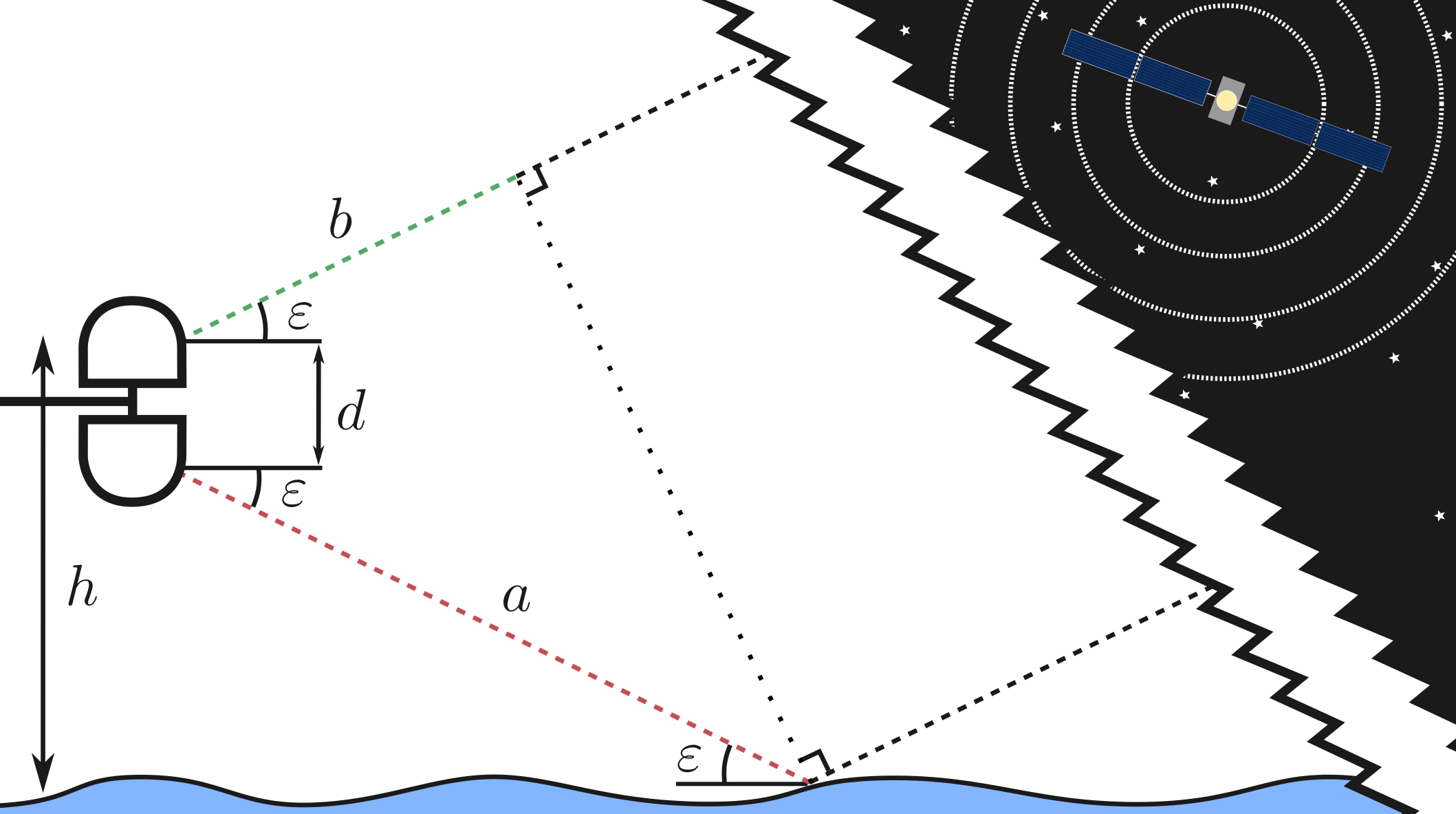
Principle
GNSS is a collective term for several satellite navigation systems, of which the most famous is the Global Positioning System, GPS. All around the world there are networks of GNSS receivers to measure the movement of the continents. A perfect GNSS receiver would only record signals that come directly from the GNSS satellites. However, because the signals are electro-magnetic waves they will also be reflected of various surfaces. The idea behind GNSS-reflectometry is to measure the effect of these reflections to learn something about the surface that caused the reflection. In this way it is possible to measure sea surface height, snow depth, ice, soil moisture, and more.
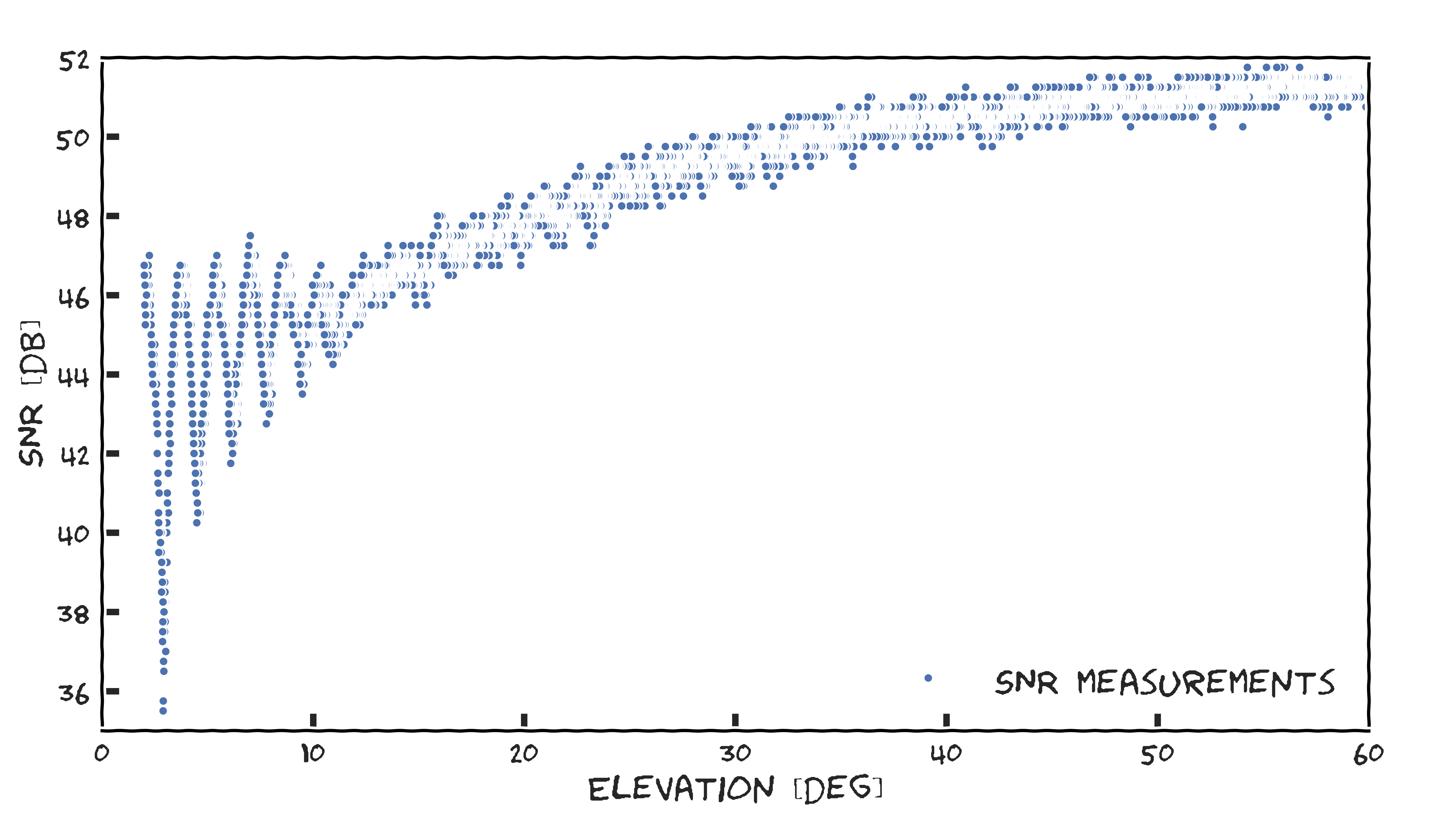
Signal-to-noise ratio variations
A GNSS receiver close to flat surface will record a very characteristic pattern. In short, the oscillating pattern change depending on the surrounding area. So by analysing the pattern we can retrieve information about the surroundings.